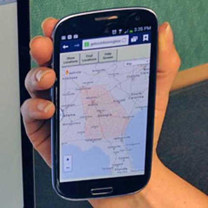
ATLANTA — The Georgia Department of Natural Resources recently unveiled an interactive map that identifies DNR-managed lands and outdoor recreation opportunities.
The Georgia Outdoor Map includes state parks, wildlife-management areas, public fishing areas, boat ramps and historic sites.
Users are able to search by category to find locations where they can camp, hunt, hike, fish or explore history.
“We are proud to offer this new resource to Georgia’s citizens and visitors,” Gov. Nathan Deal said. “We are blessed here in Georgia with a state that is rich in both natural and cultural resources.
“I want to encourage Georgians to use this interactive tool to find new places to explore.”
The map can be visited using any device with a web browser, including desktops, phones and tablets. By checking criteria fields, users can find recreational opportunities, directions, handicap accessibility, telephone numbers and website links for more details.
The tool also offers a “near me” function to help users determine which recreational opportunities are closest to them.
“With this web-based tool, users can easily see what types of outdoor recreation are available in all parts of the state,” DNR Commissioner Mark Williams said. “The map includes all DNR properties open for public use, from the smallest historic site to the largest wildlife management area.
“It’s a quick way to find boat ramps, campgrounds, archery ranges and other places for enjoying the great outdoors.”
To view the free, interactive map, go to www.georgiaoutdoormap.com.
DNR launches online map of recreation land